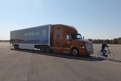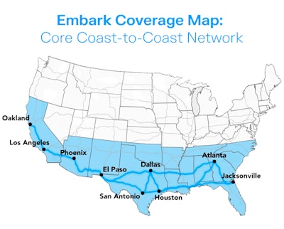
Autonomous truck tech company Embark Trucks on Tuesday launched its coast-to-coast backbone of the Embark Coverage Map, including nine transfer point sites in cities like Dallas, El Paso, Atlanta and Jacksonville, to accommodate planned autonomous freight volume in the Sunbelt market and provide anticipated operational support for carriers and shippers using Embark-powered trucks.
Embark said secured optimized real estate sites and support services through its partnerships with Alterra Property Group and Ryder, and strategically selected the nine sites to eventually automate crucial shipping lanes for its carrier partners. The expanded network that Embark is positioned to serve through these nine sites covered 9.5 billion miles of annual freight in 2020, including Dallas to Houston, San Antonio to Houston, and Dallas to Atlanta – some of the highest-volume inter-city lanes in the US. As a result, by opening these nine sites, 28% of U.S. shipping volume in the Sunbelt is available for autonomous transport by Embark’s fleet partners, who will be able to own and operate the trucks and to begin hauling goods autonomously once Embark’s technology is commercialized.
[Related: Embark completes autonomous traffic stop with Texas law enforcement]
The company said 41% of U.S. shipment miles in the expanded Coverage Map fall on lanes that are longer than drivers can complete in a single shift due to hours of service regulations, and Embark anticipates that the 3.3 million loads on these lanes should become eligible for earlier delivery once automated.
Embark's autonomous platform uses Vision Map Fusion (VMF) technology, which minimizes reliance on high-definition maps and instead leans more heavily on real-time inputs from Embark’s sensor suite, allowing the technology to navigate its environment utilizing a light and easy-to-create and -maintain map. This map-light approach, Embark claims, allows the company to expand to new markets in a way where effort does not scale with mileage. As Embark continues to build density across its Coverage Map ahead of deployment, the company said it will look to expand to additional sites and leverage other utilization structures such as pay-per-use as operations continue to scale.


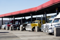
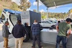
Today, the Embark Coverage Map is being used in conjunction with Embark’s fleet partners through multiple pilots. To support fleets operating on the network, Embark, through a long standing partnership, has deployed Ryder operators to certain Embark Coverage Map sites to provide inspections and support services necessary to keep trucks moving in an efficient and safe manner.