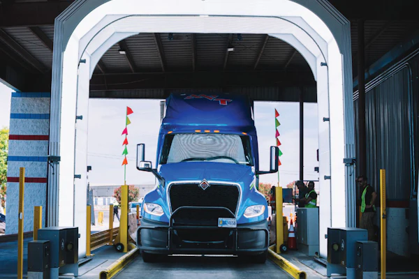
Many people use terms such as “GPS” and “satellite tracking” to describe the technology they use to remotely monitor and route their trucks and drivers. The global positioning system and wireless communications are, of course, two essential components in their system. The third component – the graphical information system (GIS) – is what lies at the heart of many potential uses of GPS to automate business processes.
Simply defined, GIS is a database of several different information layers that comprise a digital map. A GIS designed for commercial carriers includes basic geography, city streets, landmarks, highways and distances. It may also include details about roads, such as bridge heights, one-ways and intersections not suitable for right turns with 53-foot trailers. Carriers can also “geocode” their own physical markers, such as terminal and customer locations, into a GIS.
In essence, GPS is the hardware and GIS is the software component used in vehicle tracking, navigation and routing systems. GPS satellites provide specially coded signals that are processed in a GPS receiver, enabling the receiver to compute position, velocity and time. This GPS data is then channeled into a GIS overlay, or digital map, that presents this raw data with cognitive and people-oriented objects, says Alain L. Kornhouser, PhD, president/CEO of ALK Technologies.
In North America, a handful of companies, such as ALK and Rand McNally, develop and maintain GIS databases specifically for routing and navigation based on detailed truck-oriented attributes, such as routes for hazmat loads, Kornhouser says.
To keep their customers’ GIS database current with information on new road construction, road closures, new addresses, etc., ALK and Rand McNally offer periodic updates that can be downloaded from their websites into your installed software package of ALK’s PC Miler or Rand McNally’s IntelliRoute, for example. In the near future, carriers may also have the opportunity to receive real-time updates on traffic congestion via wireless communication, Kornhouser says.

Currently, companies like Rand McNally and ALK can receive up-to-the-minute traffic updates from uncoordinated sources, such as individual states’ transportation departments, that use loop detectors to record vehicle speeds at certain points. This type of information, however, is fragmented because it is not collected from a single source, says Amy Krouse, Rand McNally’s director of marketing.
A possible solution to this dilemma, Kornhouser says, is to collect GPS data on travel time in certain segments from motor carriers into a single database via wireless communications. In other words, each vehicle would be a probe to collect information and share it with drivers and fleets with vehicles in the same area.
“This is not a new concept; truckers have been doing it forever with CBs,” Kornhouser says. “The problem with that is it’s confined and only gives you a snapshot of what’s ahead and not the alternatives.” While real-time traffic updates could save time and money for drivers and carriers, many people hesitate to share their vehicle speed and location with the general public.
“People are concerned about the privacy issue,” Kornhouser says. “We have to deal with it head on and assure them that this is not big brother thing. It’s about allowing drivers to make more money.”
The process of sharing position and vehicle speed in such a manner with other carriers is well underway and will continue to become more prevalent in the future, says Chris Wolfe, vice president of Qualcomm’s Wireless Business Solutions. Wolfe says that most carriers see data sharing as a value proposition. The question is, who will be willing to pay for it?
“We’re working through it right now,” Wolfe says. “It will be another two to three years before a lot of that comes to fruition.”
As cartographers continue to develop wireless means to send instant updates, such as traffic congestion, to GIS databases, carriers can wirelessly feed this data into sophisticated route optimization software.
As trucks cross geofences (circles) that surround landmarks (triangles), PeopleNet’s Pacos system will trigger delivery of preset messages to drivers, dispatchers and shippers.
For example, A.Maze Routes, a route optimization product developed primarily for regional multi-stop delivery services by GEOCOMtms automatically recalculates the optimal delivery sequence for each driver as new data is entered into the carrier’s order entry and dispatch system. It can also re-optimize routes based on changes to one of many different “constraints” including road closures and traffic congestion, says Bernard Tetu, president of the Quebec City, Canada-based company.
In addition to using up-to-the-minute GIS and traffic data to optimize route planning, some carriers use location-based event reporting to automate the process of sending messages back and forth between dispatchers, drivers and customers. By geocoding the location of a customer on a digital map, a dispatcher back at the office would automatically receive the message “arrived at shipper” when the driver pulls into the gate.
This month, PeopleNet Communications will be adding a new service called IMessaging as it rolls out the second phase of its Pacos platform, says Brian McLaughlin, PeopleNet’s director of marketing. IMessages can also be triggered both when expected events do and do not occur.
“Automatic messaging takes a map from presenting data points to presenting knowledge and decisional data,” McLaughlin says. “GIS says ‘the truck is here,’ but with Pacos, it starts to say ‘the truck is not here’ or it says ‘the truck has just arrived, now take these actions.'”
Carriers can also use location-based event reporting to define a path of travel, a “geocorridor,” to be notified as drivers travel out of route. Another feature is “geofencing” or drawing a radius around a location to trigger an automatic message (or alert) when a truck crosses the imaginary boundary. Geofencing can be used to monitor both positive and negative events, says Qualcomm’s Wolfe. In a time of heightened security, you may decide to place a geofence around a nuclear power plant or military base.
Contrary to what you may hear from your real estate agent, in the trucking industry, the continued development – and benefit to carriers – of enhancements to GIS proves that location isn’t always everything. It’s what you do with that location that matters.