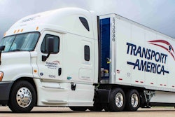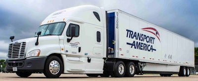
“It was a difficult winter,” says Tom Benusa, chief information officer of Transport America, which provides traditional over-the-road, dedicated and local transportation with a fleet of 1,450 trucks and logistics services. “There were lots of storms and shutdowns.”
The company’s corporate office in Eagan, Minn., was directly in the path of many storms, as were its most dense traffic lanes in the Midwest and East. Each severe weather incident ignited a chain of events to try and minimize the impact on Transport America and its customers.
An employee in the operations department was in charge of monitoring the weather and sending macro messages to drivers in the entire fleet, but this manual alerting system was not location-specific to trucks and loads; everyone received the same messages.
Driver managers, which Transport America calls fleet leaders, also would eyeball weather maps at their desks and use the company’s custom management software to identify the trucks and drivers moving in affected areas.
A distinct problem emerged from this approach, Benusa says. Drivers were not using their best judgment as for when and where to shut down and wait out the storm. Accidents were happening, and the fact that the company lacked a systematic way to manage weather events and give drivers specific instructions was partly to blame.
“It was all very manual, time-consuming and not thorough,” he says. “We began to realize that with all the technology we have, we should be able to do a better job of keeping our drivers and cargo safe.”
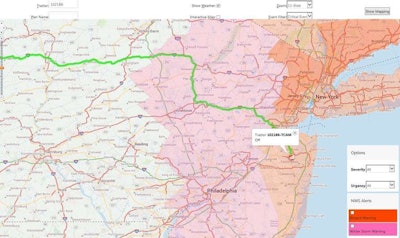 CLICK to ENLARGE: Transport America’s weather alerting system, developed using ALK Maps, sends e-mail alerts to fleet managers when projected truck routes intersect with severe weather events.
First set of alerts
Benusa hatched a plan to create a truck-specific weather alerting system that, in concept, would identify trucks moving in or into a winter storm warning, as well as shipments that could be delayed or rerouted to minimize the impact on customer service.
After looking at several commercial mapping products, Benusa determined that none had the necessary tools to automate this process. What these products could do is display the location of trucks, routes and radar weather on a map. This was only a slight improvement from what the company already had; employees still would be looking at computer screens.
“There was no way to systematically interrogate the data and routes against weather events,” Benusa says. “We were focused on a systematic approach without human intervention.”
One supplier took the idea to heart and in five months came back with something for Benusa to evaluate. “I was a bit skeptical,” he says. “I didn’t know they had taken it on as a project.”
It appeared to be a good start, and Transport America began working the new product into its operations in November 2014. The system went into full production in January.
During this year’s winter season, fleet leaders began being notified automatically – three times per day – of weather alerts that pertain to drivers and loads in their geographical network. The alerts begin for planned loads in weather events and escalate to at least once every two hours for trucks currently moving through a monitored weather event.
The system also alerts the customer service department about loads that have not been dispatched. The alert includes the estimated number of miles the load will be traveling in a warning area. With this information, a customer service representative can communicate with the shipper about changing the date or time of pickup or rerouting the load.
When a fleet leader gets an alert, he or she now can determine if the driver needs to be contacted to “make sure they are making the right choices,” Benusa says. With an alert, a fleet leader immediately can pull up a map that shows the location and speed of the truck with an overlay of the weather, current route line and planned route line for the next trip.
If the driver’s route line shows him clipping the corner of a storm warning, the fleet leader may not need to do anything. If the driver is headed directly into a storm, the leader may need to send a macro message to instruct the driver to wait it out.
The message has specific and accurate weather information and is read to the driver in the cab via text-to-voice functionality. “Above all, safety is our ultimate concern,” Benusa says.
 Tom Benusa, Transport America CIO, helped devise the plan to help keep drivers and cargo safe during winter months.
Next steps forward
The winter of 2014-15 was tame compared to the previous year. After using the new alerting system for about three months during winter this year, “we certainly understood what trucks are moving that shouldn’t be,” Benusa says. “Drivers understood we knew that as well.”
Communicating with drivers about their current and future state of affairs has been a positive development, he says. In instances where drivers are told to pull over, fleet leaders have an opportunity to reinforce the fact that safety comes first, even for hot loads.
“Drivers appreciated us communicating with them,” Benusa says. “I’d like to say we have not had any event, but that would be a lie. We’ve had less events, but last year was one of the harshest winters on record.”
As Transport America headed into the summer season, its developers tweaked the alerting system for “short-lived” weather events such as a severe thunderstorm, tornado or high wind warnings.
“We still have a lot of work to do to understand if we can utilize this in the same way as a winter storm,” Benusa says. “The summer presents a new opportunity to utilize the tool.”
By next winter, Transport America plans to send truck- and route-specific weather information macros directly to drivers by 7 a.m. every morning. It also plans to use its maps tool to take a deeper dive into route analysis by overlaying planned versus actual routes for drivers.
Another new functionality is to update its route planning system to help with road closure incidents due to accidents, weather and anything else that otherwise would keep its trucks stuck in traffic for hours at a time. The company can lay a virtual polygon over any stretch of road on the interface of its commercial mapping product.
This action instantly interrogates the company’s dispatch database to identify any trucks in the vicinity and create a new route if needed. The company uses an in-cab navigation system, but this product does not have the data to reroute the truck dynamically based on road closures.
“Until technology in the cab gets to that point, we will use the tools in our back office to keep drivers rolling and keep them safe,” Benusa says.


