










It is almost impossible to get lost in 2026, thanks to the supercomputer in most pockets. Map applications can point nearly every user to any known address in seconds — if they are in a passenger vehicle.
Most consumer-facing apps do not account for tight turns, truck routes, narrow tunnels, weight limits, or low bridge clearances — not even the global leader in app-based mapping, Google Maps. Google, which maintains the largest database of local businesses, public transit routes, and offline map features, rolled out Large Vehicle Routing by Google Maps Platform this week.
The technology, now generally available nationwide across the company’s Routes API, Route Optimization API, and Navigation SDK, directly integrates vehicle dimensions and road regulations into routing algorithms.
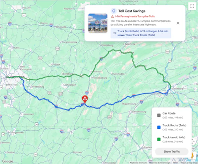
Google's new Large Vehicle Routing system allows logistics companies to input specific vehicle profiles, including height, weight, length, width, axle count, and hazardous material classifications. The system then calculates routes, mileage, and travel times tailored specifically to those parameters.
Fleet-wide features include:
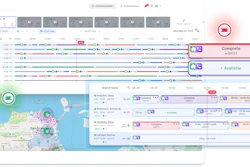
- Customized trip planning: Dispatchers can optimize single trips or complex, multi-vehicle schedules while factoring in road restrictions and dynamic toll avoidance.
- Specialized arrival estimates: A dedicated large-vehicle ETA model combines commercial speed patterns with real-time and predictive traffic conditions.
- Driver navigation matching: A built-in "route token" ensures the planned compliance route transfers directly from dispatch to the driver's cab via the Navigation SDK, eliminating route discrepancies.
- In-cab restriction alerts: Drivers receive turn-by-turn guidance displaying visual callouts for upcoming clearance and weight limits inside the familiar Google Maps interface.