In this week’s CCJ Tech Shorts, we’ll take a look at a new AI-driven driver safety solution, Trucker Path’s newest marketplace member, a fleet maintenance management software update that aims to break language barriers and mobile mapping services for tech deployment at warehouse and distribution facilities. CCJ Tech Shorts is a weekly roundup of technology in trucking.
Contents of this video
00:00 Tech Shorts intro
00:29 AI-driven driver safety solution
01:06 Truck Parking Club
02:13 Fleetio Go’s Spanish language option
03:27 3D mobile mapping services
00:00 In this week’s CCJ Tech Shorts, we’ll take a look at a new AI-driven driver safety solution, Trucker Path’s newest marketplace member, a fleet maintenance management software update that aims to break language barriers and mobile mapping services for tech deployment at warehouse and distribution facilities.
00:29 DOTsfty, a provider of AI-driven driver safety solutions, has rolled out new technology that enables lean safety teams to provide real-time coaching to drivers on all unsafe driving events. Its generative AI, multi-modal large language model is trained on video footage collected from around 5,000 real-world dashcam events gathered from early customers. The AI analyzes video to infer what’s happening and suggest what the driver should do in real time. DOTsfty plugs into existing ELD apps, including Samsara, Motive and Geotab.
01:06 Truck Parking Club has joined the mobile app Trucker Path’s marketplace. Truck Parking Club partners with trucking companies, truck repair shops, CDL schools and other entities that can accommodate truck parking at convenient locations for truck drivers. This gives the one million truck drivers who use the Trucker Path app an easy way to search for and reserve parking at locations in more than 30 states. Drivers who join the Truck Parking Club through the Marketplace in the Trucker Path app can:
• Access facilities for daily parking in advance. Some locations may also offer hourly, weekly and/or monthly rates.
• Search for parking using an interactive map that displays available locations, with each parking spot pinned with the facility’s name and its daily price.
• Search for parking when planning a route or by finding a parking spot near a specific location.
• View parking location information, including daily costs and available spaces, as well as amenities such as restrooms, 24/7 access, etc., and contact 27/7/365 customer support (staffed by former drivers) to ask any questions.
02:13 Fleet maintenance management software company Fleetio has launched a Spanish language option in its mobile fleet maintenance app, Fleetio Go.
Fleetio’s vice president of product (Esteban Contreras) said, “At Fleetio, we understand the importance of a diverse workforce within the fleet maintenance industry. By offering Fleetio Go in Spanish, we’re empowering nearly a quarter of our customer base with the tools and resources they need to excel in their roles. This not only simplifies daily tasks and improves communication, but ultimately equates to a safer, more efficient fleet operation for everyone involved.”
Simply setting the mobile device default language to Spanish allows users to automatically experience Fleetio Go in Spanish upon login. Users can also switch back and forth between English and Spanish at any time within the app. Fleetio also offers Spanish Help Center articles, videos and support via email or chat.
By breaking down language barriers, Fleetio Go in Spanish unlocks several key benefits for fleets, including reduced training time, increased task completion and improved compliance, translating to a more efficient and streamlined operation, with reduced vehicle downtime, lower maintenance costs and improved safety.
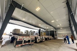
03:27 Velociti Inc., a global provider of technology deployment, support and integration solutions, has added mobile mapping services to its deployment capabilities to deliver highly accurate and more efficient means of collecting spatial data for the planning and designing of technology solutions at warehouse and distribution facilities.
Velociti CIO Jim West said, “Implementing these new capabilities allows us to map and document a space prior to installation and capture critical measurements before the design process begins. This streamlines planning and engineering processes, allowing those activities to happen off site to reduce disruption to the customer’s operation. It also leads to more efficient deployment methodology and workflow, and ultimately more effective technology solutions for our customers’ business needs.”
Velociti uses a range of devices for its Mobile Mapping end-to-end reality capture solution. Its suite of surveying tools includes the Total Station Unit for 3D space dimensioning, including distance and angle measurements. A wearable mobile mapping solution that incorporates panoramic cameras and LIDAR remote sensing to measure ranges captures highly accurate data while providing the flexibility to navigate complex indoor and outdoor environments. Drone surveying for streamlined aerial imaging is available to accelerate and simplify site planning and design surveys.


