Prophesy Transportation Solutions, provider of trucking and logistics software solutions to the transportation industry, has announced the availability of ProphesyMaps, which brings Microsoft Bing Maps technology to its Prophesy DispatchSeries transportation management system. ProphesyMaps is a new feature for users of the Prophesy DispatchSeries solution, which now uses licensed Bing Mapping technology.
The solution is designed to geocode and reverse-geocode to locate vehicles, trace routes and pinpoint origins and destinations, all on one centralized map. The ProphesyMaps interface is integral to the Prophesy Dispatch system and can be accessed via a simple menu. According to the company, the ProphesyMaps interface includes:
• The ability to zoom in and out easily by using a mouse or buttons on the new system interface;
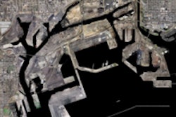
• Aerial views that allow users to see locations in real time;
• Mileage database updates used to effectively generate routes;
• Views of an enroute truck’s current location as well as the route generated by the system and the actual route taken, in differentiating colors;
• Push-pin plotting of load origin and destination and clearly marked travel routes; and
• The ability to easily change loads and locations plotted from within the map view.
“Prophesy is happy to offer the enhanced visual capabilities provided by Microsoft Bing Maps within the new ProphesyMaps module,” says Bill Ashburn, Prophesy vice president. “The advanced features of this tool will allow customers to better manage their enroute vehicles.”


![Reintroducing The Mack Anthem Rebuilt For Regional Haul[79]](https://img.ccjdigital.com/mindful/rr/workspaces/default/uploads/2026/07/reintroducing-the-mack-anthem-rebuilt-for-regional-haul79.FdrR1gEDrK.jpg?auto=format%2Ccompress&fit=crop&h=167&q=70&w=250)