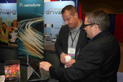
 John Elliott, CEO of Load One, receives a demo of Netradyne’s new RiskMap feature during the TCA conference from Adam Kahn.
On Mar. 27, the chief executive of expedite carrier Load One, John Elliott, stopped by the Netradyne booth at the Truckload Carriers Association’s annual convention to see a demo of a new risk management feature.
Netradyne recently added a new RiskMap feature to its Driveri (pronounced “driver eye”) vision-based safety system for no extra charge.
Load One is among the first motor carriers using the Netradyne Driveri system, and is installing it in a fleet of over 400 vans, straight trucks and tractors.
During the demo given by Adam Kahn, Netradyne’s vice president of fleet business, Elliott saw a RiskMap populated with Load One data.
Starting near the company’s headquarters in the Detroit suburb of Taylor, Mich., Elliot saw a few circles of varying sizes at intersections on a route leading to nearby Interstate 75. The size and color of the circles represented the volume of risky incidents by location that had been captured and analyzed by the Driveri system.
Kahn explained to Elliott that whenever Load One drivers go through intersections, the Driveri cameras in his vehicles use machine vision to detect if the light was green, yellow or red. Driveri can also detect when drivers rolled through a stop sign.
RiskMap also shows areas where the camera system detected incidents of reduced following distances, increased speed relative to traffic and incidents of vehicle damage.
As Elliott scanned the map to assess the severity of risk by location, he noticed a “cluster point” in Bowling Green, Ohio, off from Interstate 75.
“Why are my drivers coming off the highway?” he asked.
Kahn said fleet managers could use RiskMap to adjust their routes to avoid dangerous intersections. They could also bring in traffic flow information to assist with route planning.
Overall, RiskMap helps fleet managers review, evaluate and modify their operations and routes to increase safety, Kahn explained.
Elliott suggested that RiskMap could be improved with automatic alerting based on historical data. He would like drivers to receive location-based alerts to raise awareness of risk such as intersections and interstate ramps with high density traffic.
The alerts could be sent to the company’s in-cab Omnitracs IVG system, Elliott said, and be communicated to drivers one-half mile before they reached an on-ramp or other risky location, for example. The alerts could be simple instructions like “Take extra caution ahead,” he said.
Kahn agreed and said alerting will be a future enhancement. Kahn also said that Netradyne wants to provide its customers with a community view of risky locations rather than limit visibility to data captured from their own fleets.


